|
|
|
|
|
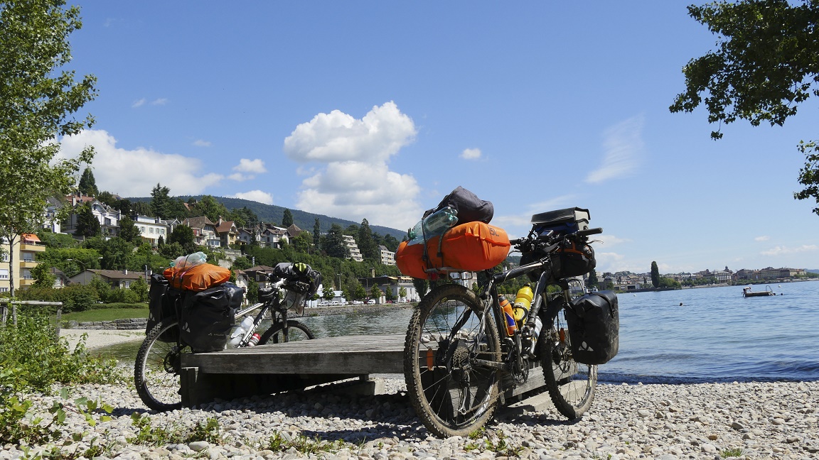
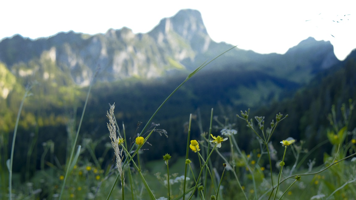
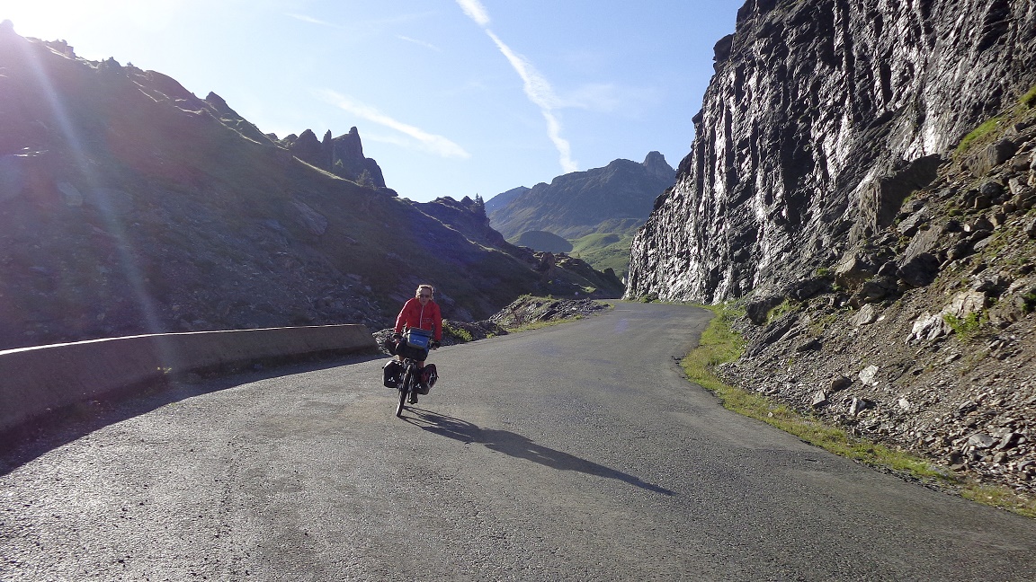
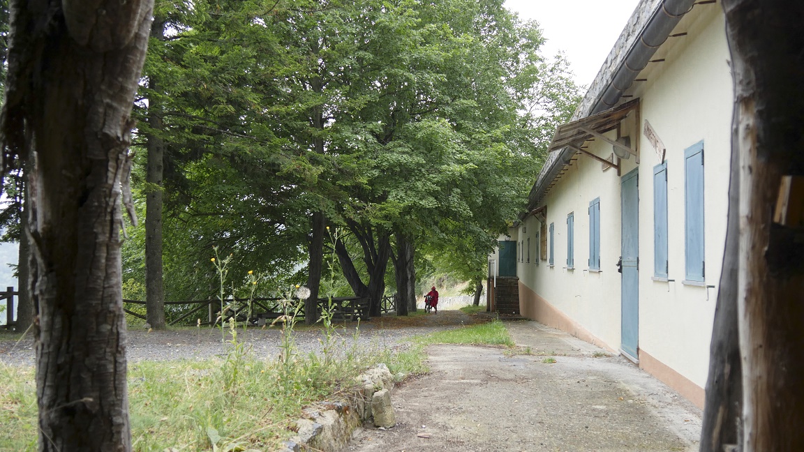
DAY 1
Genève - Chanelaz
0 km / 0 md+ / 0 md- |
|
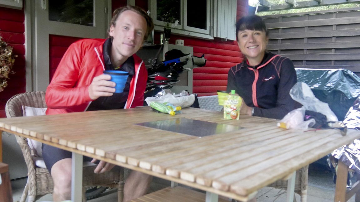
On this day of
July, everything is ok. We are ready with a big smile! we are
clean, well shaved, dry despite of the morning rain, we feel good,
we had a good night in a very comfortable bed, the bags are filled
with good things to eat... but for how long? Meeting is scheduled
at the train station of Lyon Part-Dieu at 10am. All
stories have a beginning, excitement is palpable, envy of the
project has grown for months, legs are sharpened, the route is
in the head ... That the show must go on !!
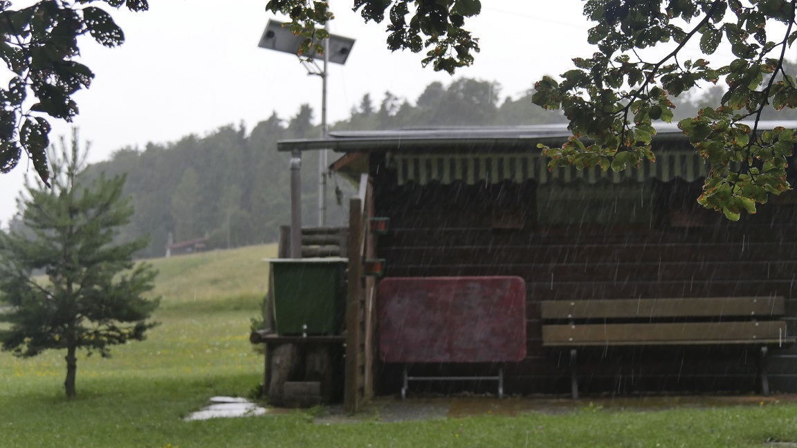
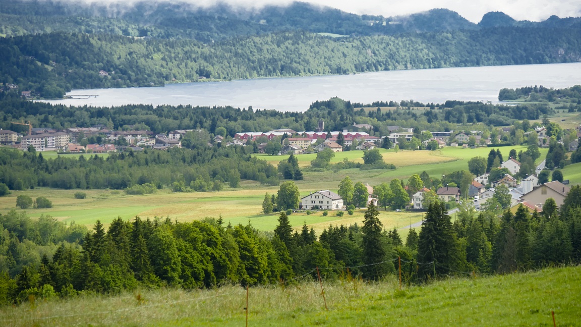
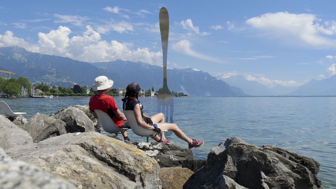
After a rainy
morning and a train journey, it's an grey arrival in Geneva, the
first laps are held back by a downpour, forcing us to take refuge
in public toilets on the banks of Lake Geneva. Cool. The
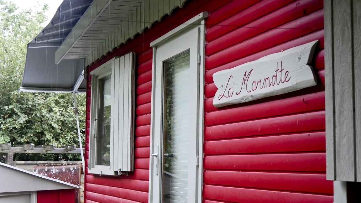
road becomes more enjoyable, especially after Nyon ... when it
goes up. Less people, beautiful scenery, greener, with beautiful
views of the lake and the forests of the Jura. It arises in an
area of bungalows, nobody ... tonight is the final of the World
Cup: we will know the result three weeks later! Gut!
|
|
|
|

|
 |
|
|
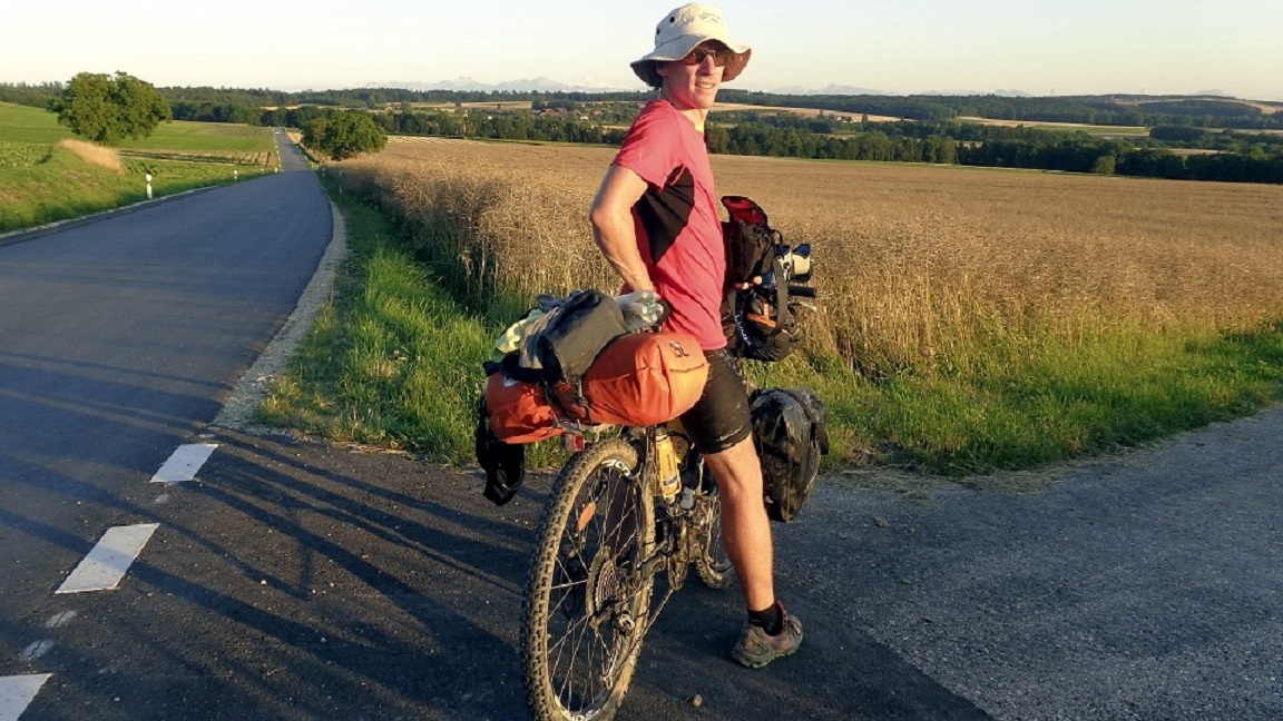
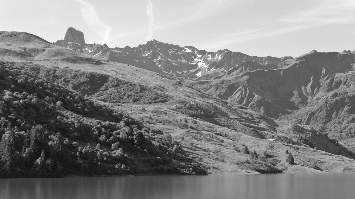
DAY 2
Chanelaz - Creux-du-Van
95,2 km / 1988 md+ / 211
md-
|
 |
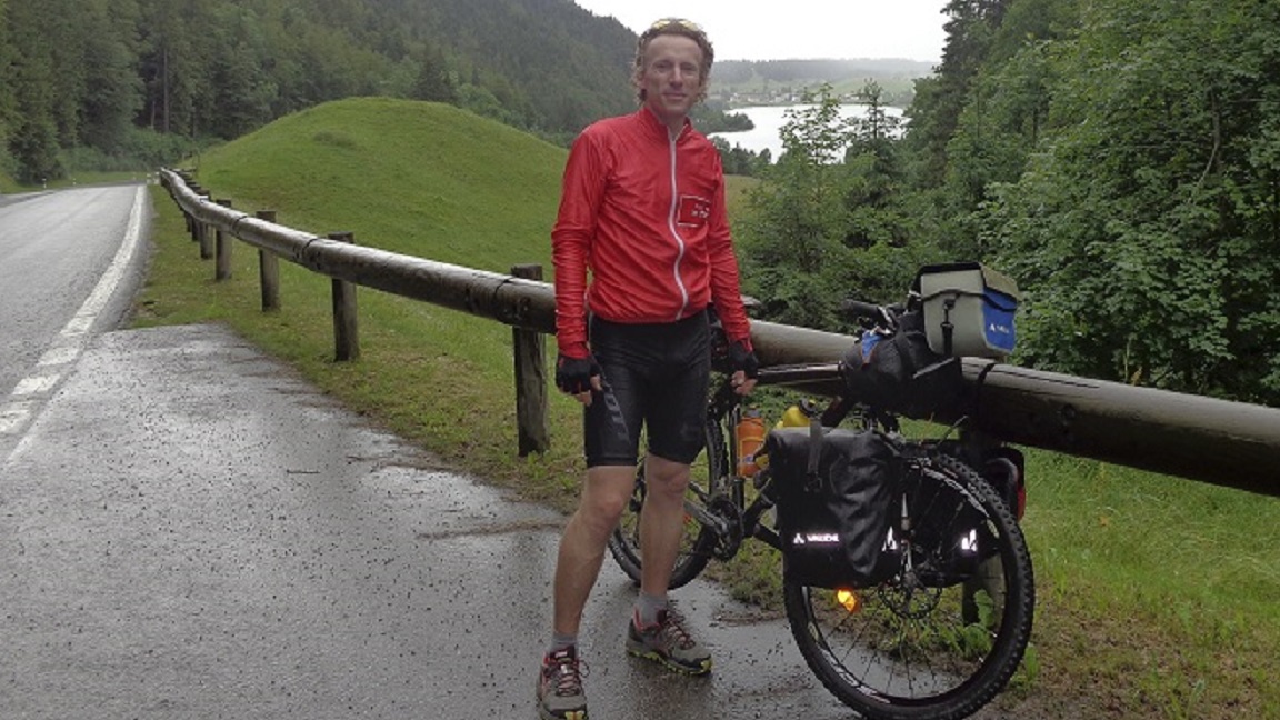
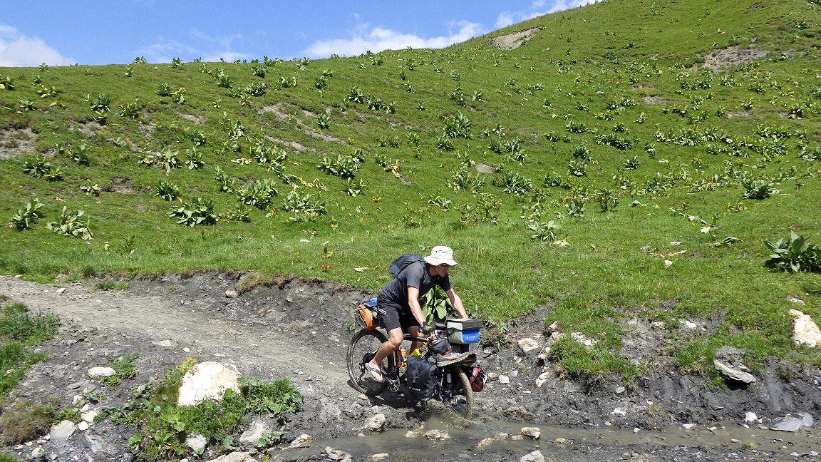
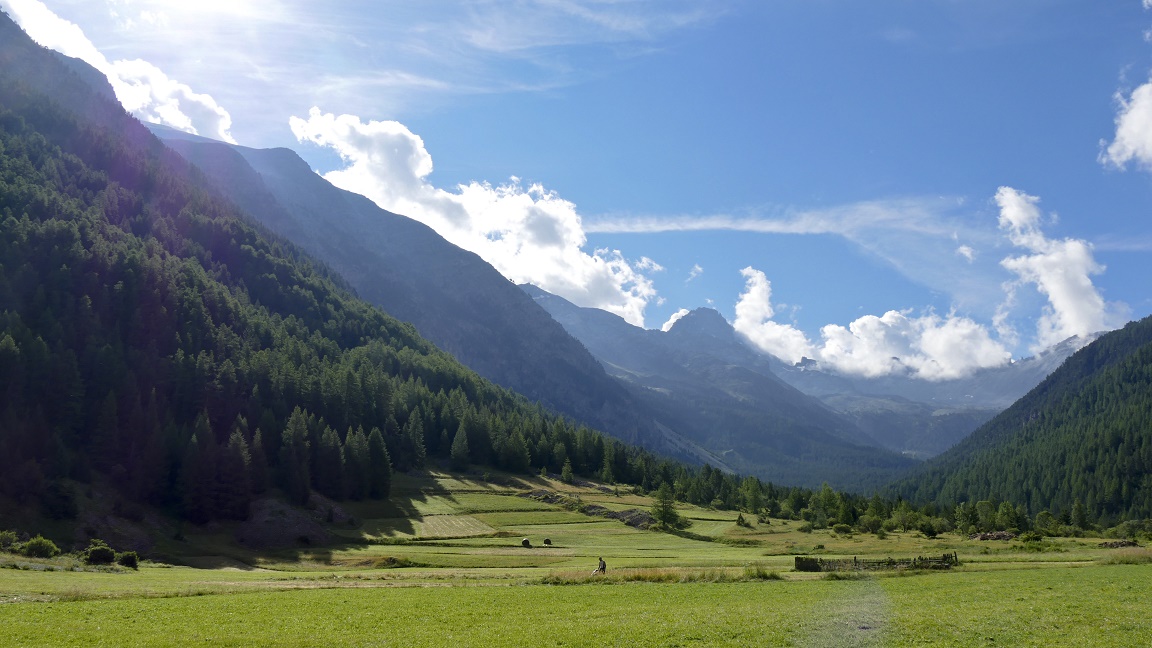
The morning is wet, but we
are dry. We start with a 8 km straight-line acrossing the plateau
of Amburnex and green landscapes (with all that rain, there is
no surprises). The road is wet, then we are wet in Vallorbe, we
take a real shower! After a bit in
France, we cross the border on a small path (not even marked on
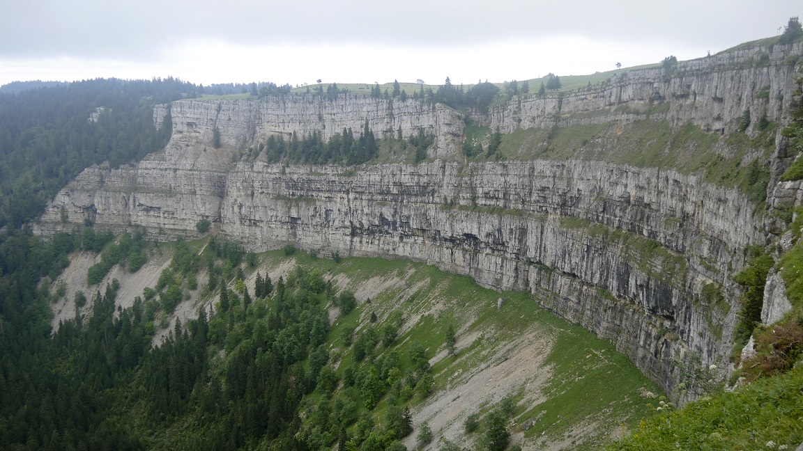
the map) to get to St. Croix. The evening climbs up a little,
then a lot ... and passionately on the grass. I'm on top of the
Creux du Van, I'm the king of the world! Deep breaths.
The place was forbidden cycling and camping? Oops, sorry. Now
You See Him, Now You Do not.
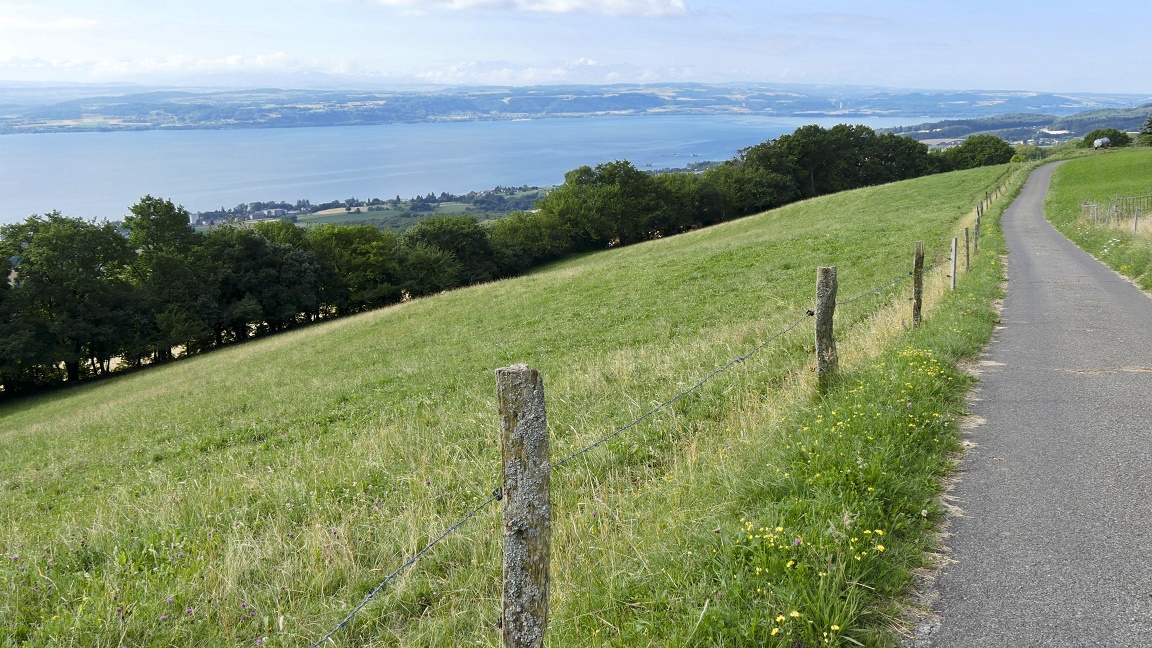
For the first time, we go down
(and under the sun!). Lake Neuchâtel is as blue as the Mediterranean
sea and Val who dreamed of spending her vacation at the seaside...
The next part is a dense jungle to cross in Cudrefin: trunks,
vines, prickly shrubs, mud up to the ankles. We put the tent on
the heights of Suchy, facing the Mt Blanc. Peaceful evening in
the countryside. With the sunset, it's another day in paradise
|
|
|
|
|
|
DAY 3
Creux-du-Van
- Suchy
93,5 km /
660 md+ / 1528 md-
|
|
xx
|
|
|
|

|
|

|
|
|
DAY 4
Suchy - Villeneuve
63,5 km / 375 md+ / 1491 md-
|
 |
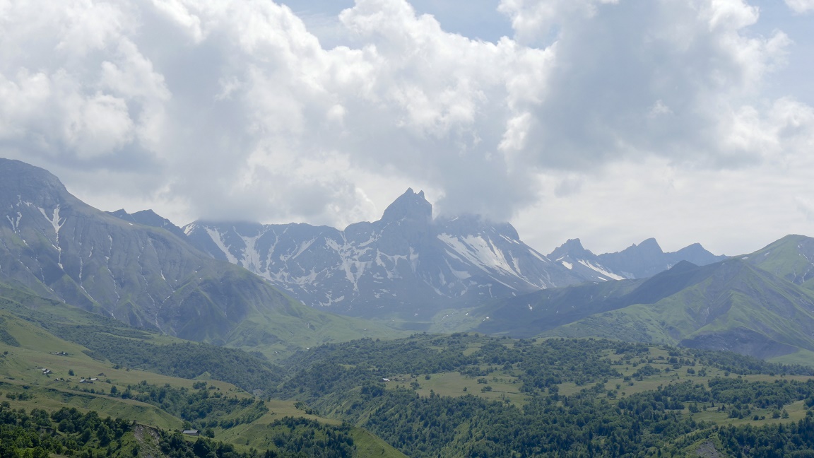
During the trip there are beautiful landscapes,
but some are breathtaking. Having Mont Blanc face to face is a
luxury, worse... it's priceless. All these efforts find meaning
in a second, just by opening my eyes! Just listening the nature,
feeling the wind, touching the flowing grass while driving. It
is these moments that I enjoy the most... Love it! No
particular difficulty for today. A small (big) thought of my last
trip to Lausanne, I still love Switzerland, me!
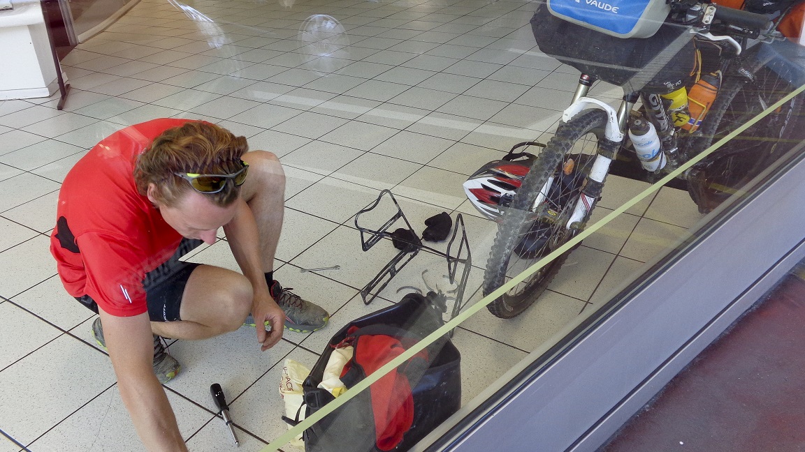
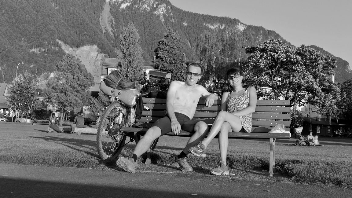
Hard start in
Lausanne: I break the fixation brackets of my bags bike (bam,
everything is dropped in a second). Miraculously, at 300 meters
is an automotive workshop where I spend half a day to refix everything.
A big thank you, guys. Then it is a
succession of beautiful cities which are crossed by bicycle path,
among vineyards and Leman lake. It's crazyness in Montreux, thousand
of people. There is a bit of quiet in Villeneuve, facing the Dents
du Midi to settle the tent.
|
|
|
|
|
|
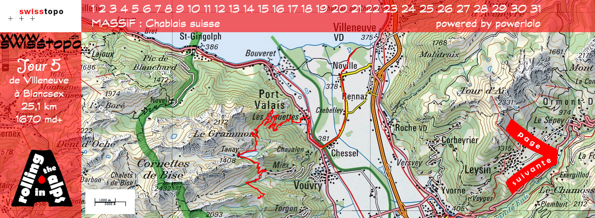
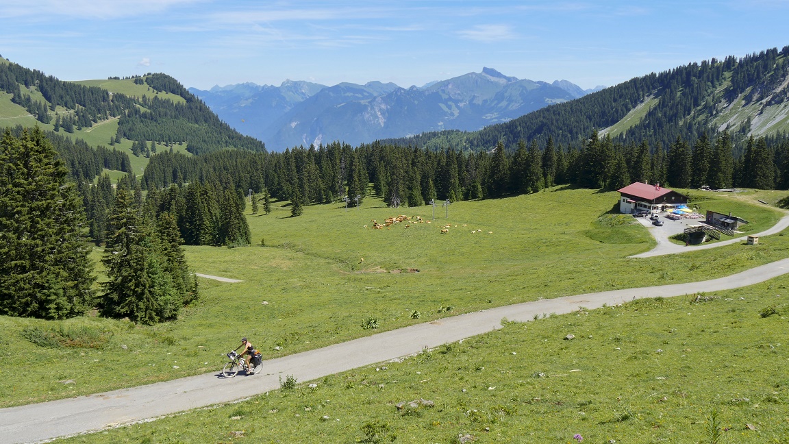
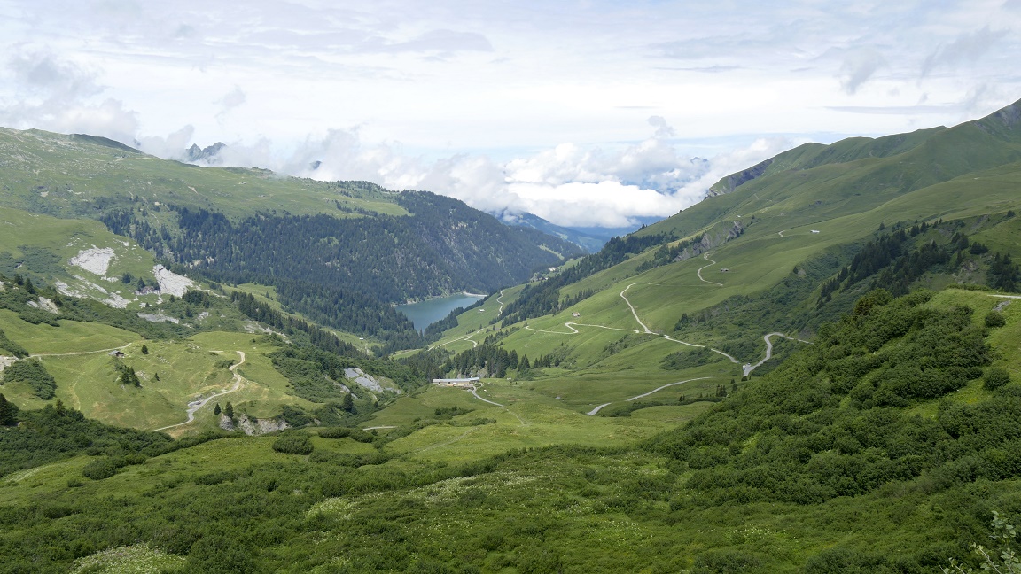
DAY 5
Villeneuve - Blancsex
25,1 km / 1670 md+ / 475 md-
|
|
The day looks
beautiful because everything starts today. Hardly time to fill
the cans, the climb is churning legs. The path turns easily into
the forest with beautiful views over Lake Geneva. Then comes the
drama when we get on a trail: GPS announces less than a kilometer
bird's-eye that will be done in almost 2 hours ... the bike with
bags is really heavy, the path is impractical, too stony, too
steep. In brief, we have to push... forced to catch its breath
a few seconds every 5 feets ... we are not arrived!
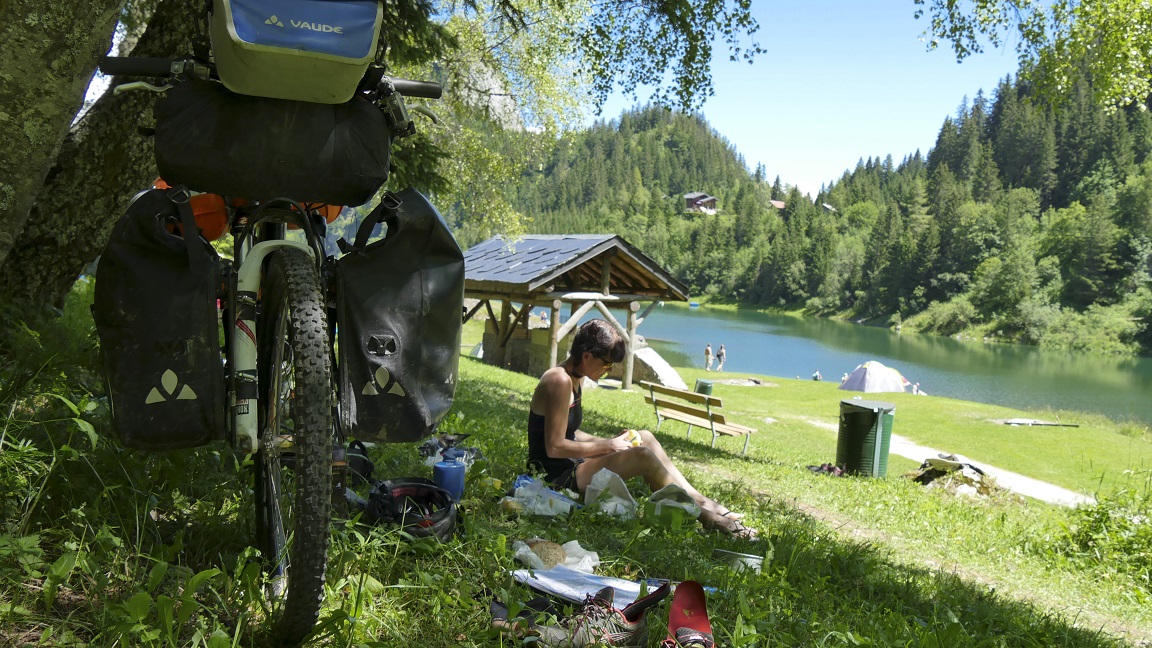
After a well-deserved lunch break at Lake Taney, we continue the
road 400 meters -evation loss swallowed in 2 km ... it is like
20%, no? Better to do it on the way down, to join Miex.
The next part
is still a beautiful climb on a forest path, then on a more perilous
single track. The camp will be settled at the Blancsex pass (no
sexual meaning, please!) at 1567 meters. We spend a nice evening,
rocked to the sound of cows, and mosquitoes attacking at 9 pm.
Anyway, the are tired, we go to the "bed"...
|
|
|
|

|
|

|
|
|
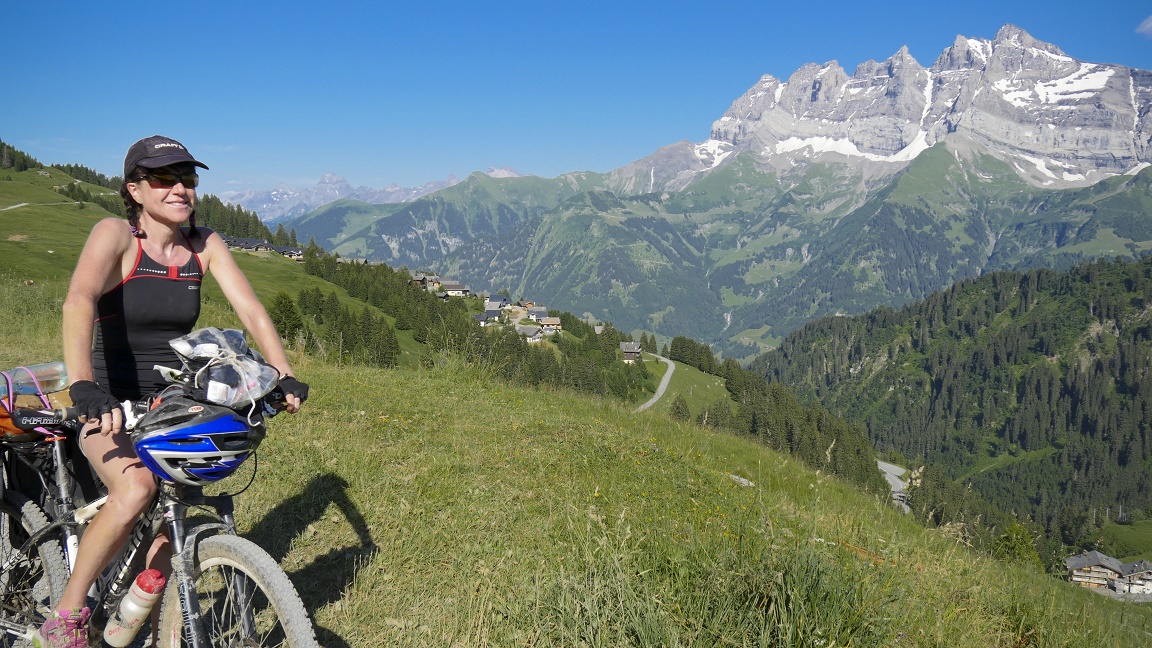
DAY 6
Blancsex - Champéry
47,9 km / 1760 md+ / 2264 md- |
 |
We wanted to leave early...
we took off around 10 am from the Blancsex refuge after a long
breakfast: 2 coffees and the last part of our carrot cake (sooo
good!). Stops "strawberries" punctuate the morning to
the pass of Bellevue... aptly named. In
Morgins, the Mecca of downhill mountain biking, there is a little
off with our bike bags, it's like being from the same "2
wheels" family, but we can not understand! The wind cools
the machine because it is (very) hot. Even the brakes are smoking!
We continue in the Morgins valley with the peaks of Avoriaz in
the crosshairs, and then straigh South... in front of us stand
the Dents du Midi, a sublime paradise for hiking. The afternoon
is very nice, relatively less stock, 2 or 3 hard climbs (short
but mighty), and finally 30 minutes of non-stop descent to Champéry,
pure happiness. Arriving time: 7.15 pm.
Tonight we sleep under a bridge
... what a contrast with this chic village, where we find that
wooden chalets and 4x4 Mercedes. Viva cycle touring.
|
|
|
|
|
|
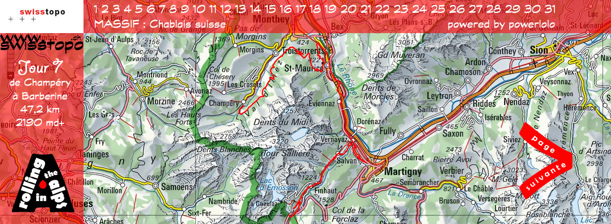
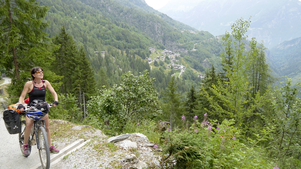
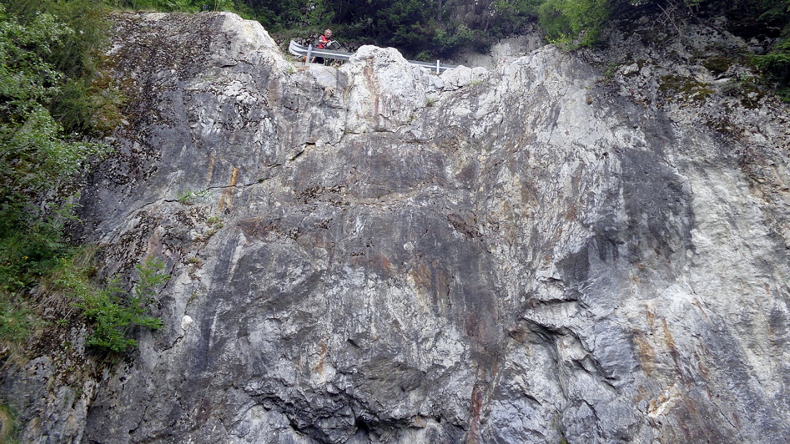
DAY 7
Champéry - Barberine
47,2 km / 2190 md+ / 2068 md-
|
|
Today is an early
morning departure: we must move quickly forward, because we were
told that storms arriving on us within 2 days. Time to liquidate
our Swiss currency to buy a piece of bread and cheese (God, that
life is so expensive for French guys), here we are trudging to
climb around the Dents du Midi. Nobody on the road, big elevation
gain difference (again!), pretty lights in the morning, beautiful
view of the Rhone Valley, it heats in the sun.
It takes beautiful
lanes to Martigny, back to 400 meters above the sea.
To exit the Rhone valley, several routes are available to us:
the road seems the most "simple" to go up the 1000 meters
gain elevation to Tretien. A big thank to the Swiss apples that
bring us some strength for the afternoon, and I do not forget
the wild strawberries and raspberries flashing red on the edge
of the road. Dug into the rock, the
forest path to Finhaut is wonderful, quiet and wild. It goes down
to Châtelard to cross the border to sleep in a shed ...
reserved to donkeys! It is 9pm.
|
|
|
|

|
 |
|
|
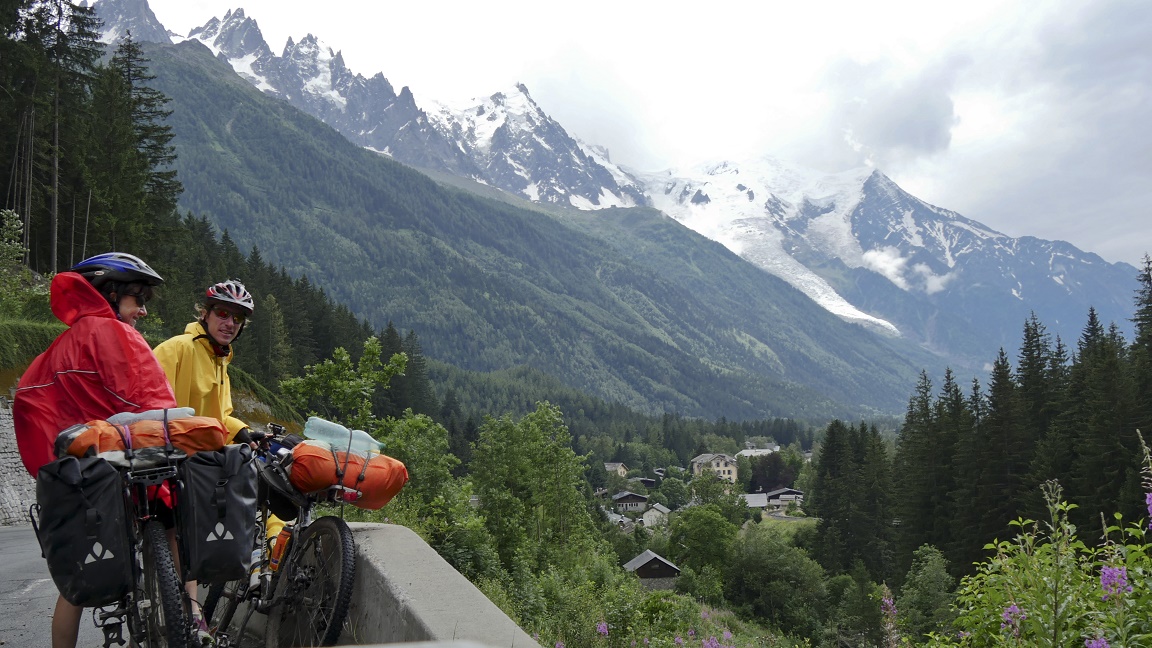
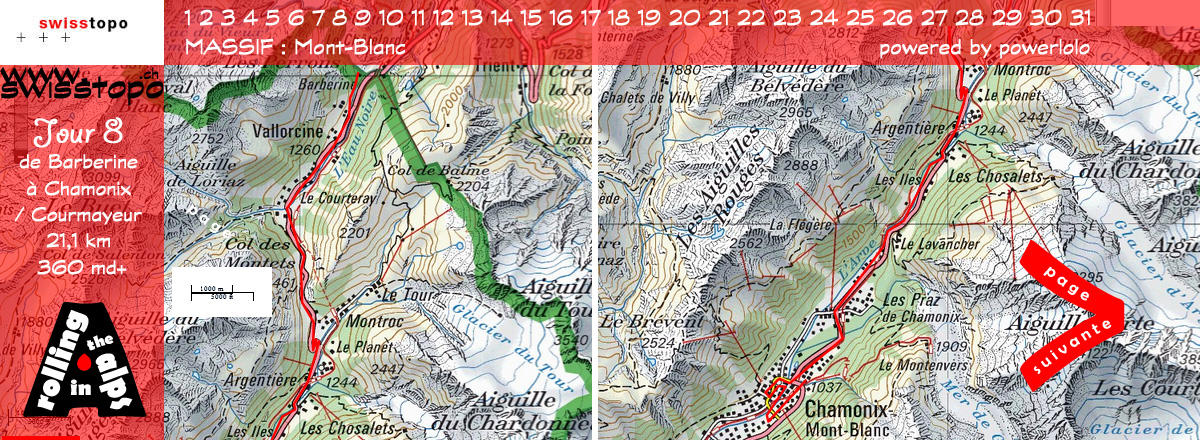
DAY 8
Barberine - Courmayeur
21,1 km / 360 md+ / 492 md-
|
 |
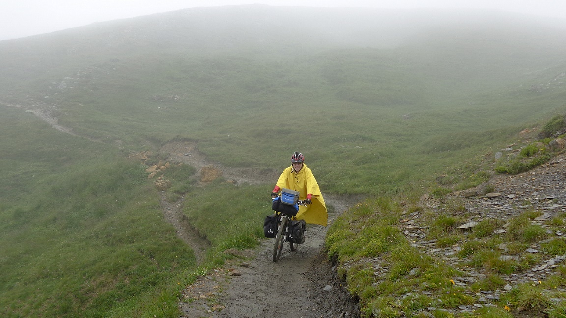
At 8am, weather is ok. Just
the time to pack our stuff in the bags, it's raining. We hesitate
before leaving, the sky shows signs of hope, so let's go. The
panchos are out a few minutes after departure. We look smart in
bright red and canary yellow panchos... well it's mostly my flip
flops that gzt me really cool: I have the greatest look at the
col des Montets Pass.
We can not say that the landscapes
are fantastic, Mont Blanc and red Needles (aiguilles rouges )
are in the fog, roads are soggy in Vallorcine and Argentière.
Chamonix is well-known for the beauty of its natural surroundings,
the Mt Blanc. But if the weather is grey and you can not see the
Mt Blanc, your mind is black! Fortunately trailers in shorts with
their frog legs give color to the city! We take the tunnel (by
bus if need to be specified) to reach Italy and Courmayeur, there
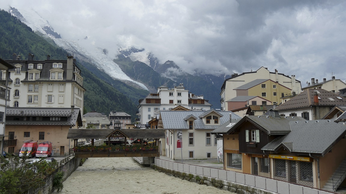
is no more beautiful weather on the other side! Oh my God, are
we really in August? We ride around
in the city center, not much to do excepted to have a hot coffee.
|
|
|
|
|
|
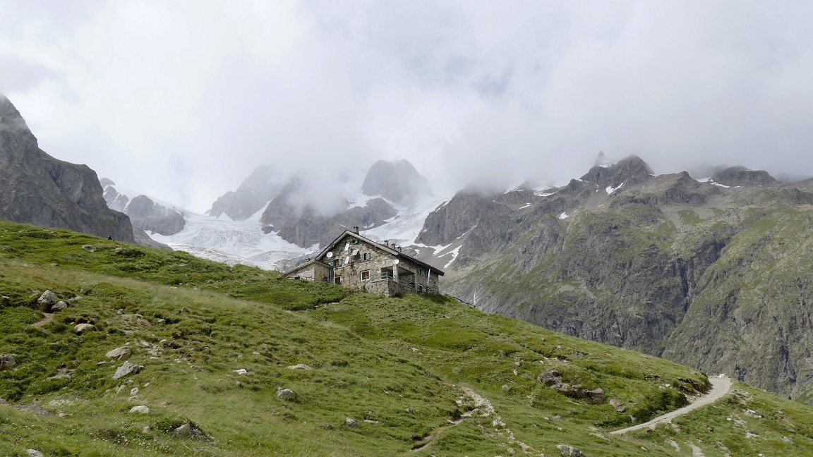
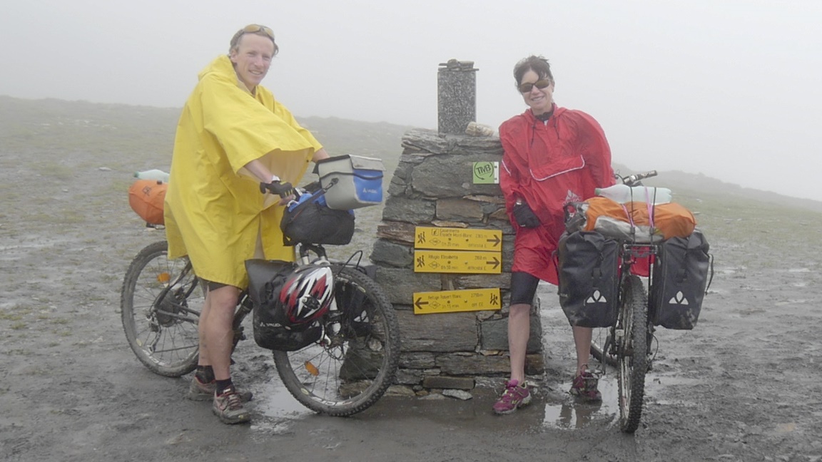
DAY 9
Courmayeur - Refuge Elisabetta
Soldini
15,2 km / 975 md+ / 48 md-
|
|
xx
|
|
|
|

|
|

|
|
|
DAY 10
Refuge Elisabetta Soldini - Refuge
du Plan de la Lai
21,7 km / 905 md+ / 1244 md-
|
 |
xx
|
|
|
|
|
|
DAY 11
Refuge du Plan de la Lai - Aigueblanche
51,3 km / 1425 md+ / 2731 md-
|
|
xx
|
|
|
|

|
|

|
|
|
DAY 12
Aigueblanche - St-Jean de Maurienne
61,6 km / 1915 md+ / 1901 md-
|
 |
xx
|
|
|
|
|
|
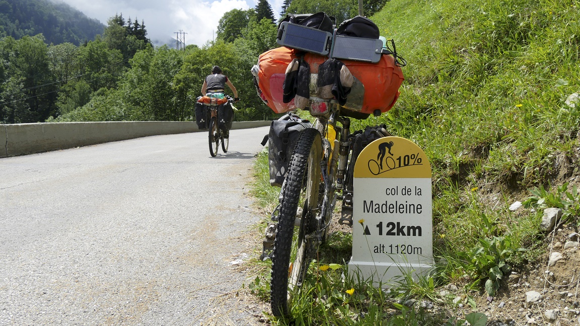
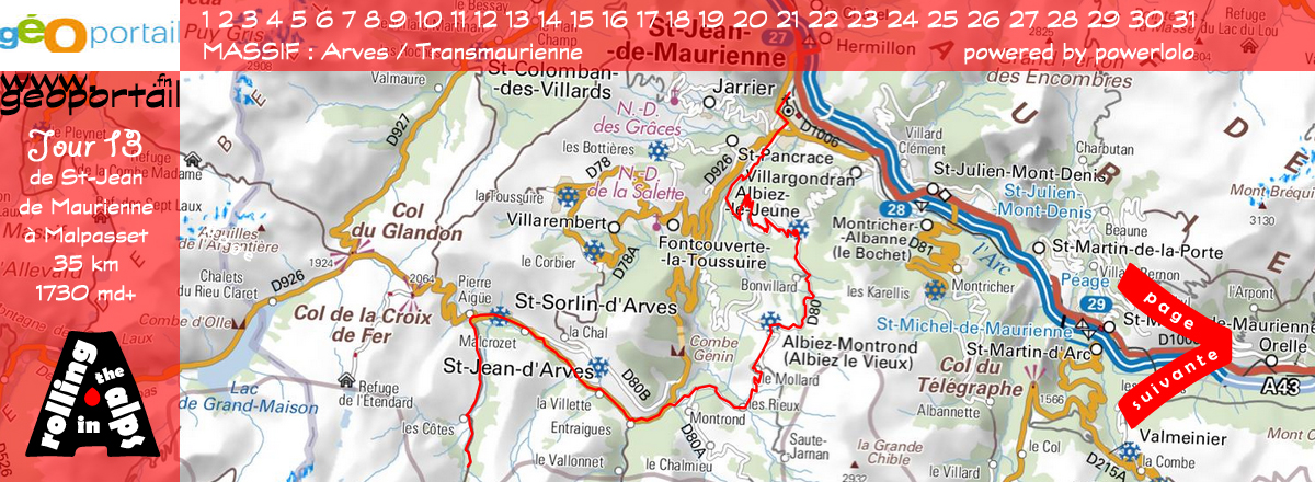
DAY 13
St-Jean de Maurienne - Abri de
Malpasset
35 km / 1730 md+ / 534 md-
|
|
xx
|
|
|
|

|
|
|
|
|
DAY 14
Malpasset - Ch. Prés nouveaux
3,6 km / 420 md+ / 27 md-
|
 |
xx
|
|
|
|
|
|
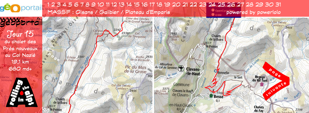
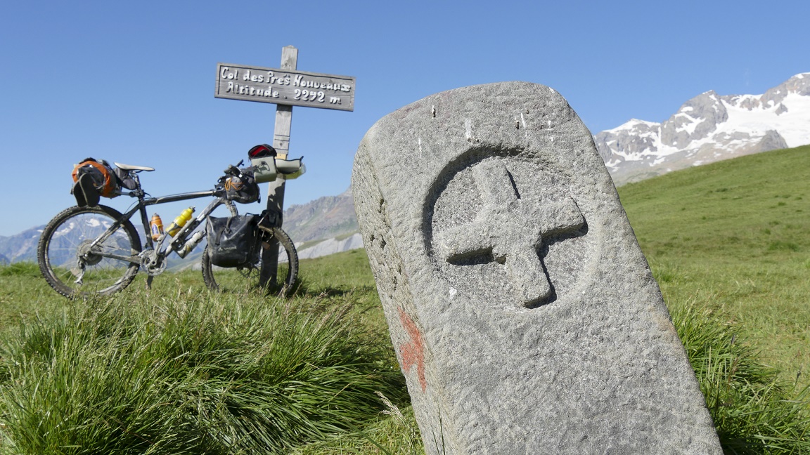
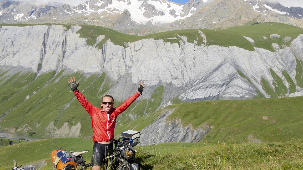
DAY 15
Chalet des Prés nouveaux
- Col Nazié
19,1 km / 680 md+ / 908 md- |
|
Anothey evening
in paradise. The trail follows the stream of Valletta, then moves
South in the valley. The dream is too good... after a few pedal
strokes, this "too perfect" trail becomes too stoned,
cows and rain turned the ground into a real battlefield! Not too
rolling, shame! We went shopping for
the next days in Besse-en-Oisans, before climbg to the plateau
Emparis. We camp at the Nazié pass, where 1500 sheep and
their shepherd are waiting for us. Beautiful evening at 1902 meters.
|
|
|
|

|
 |
|
|
DAY 16
Col Nazié - Chazelet
15 km / 700 md+ / 807 md-
|
 |
xx
|
|
|
|
|
|
DAY 17
Chazelet - Col des Rochilles
34,3 km / 1610 md+ / 1052 md-
|
|
xx
|
|
|
|

|
|

|
|
|
DAY 18
Col des Rochilles - Lac pont Baldy
42,2 km / 490 md+ / 1495 md-
|
 |
xx
|
|
|
|
|
|
DAY 19
Lac pont Baldy - Clot Henri
48,2 km / 2125 md+ / 1410 md-
|
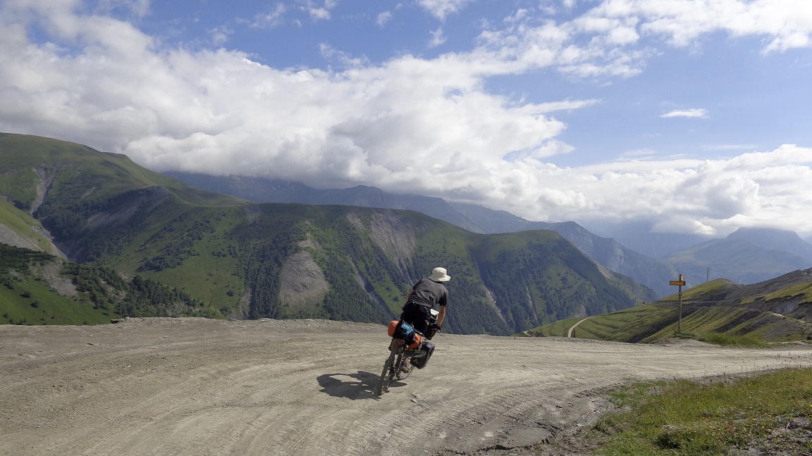
|
Hey, hey ! Very
big day, but it is not known that morning! For a grocery store
Cervières could use some work ... That Izoard right ahead!
There is madness horns; the summit at 2340 m, a mom welcomes me
"Congratulations, you ride it!" I will be ashamed, so
I put a little sunscreen. Val is not bad defending, 15 minutes
behind the red jersey. Descend Casse
Desert, lunar where you have lunch and then we continue through
Lake wheel, so peaceful, before swallowing faisselles Chateau-Queyras.
The day could
have stopped in Chateau-Queyras at 5 pm but the fate decided differently...
11 km to ride and 800 meters -evation gain to climb on a forest
road to Bucher peak. We even find time to interview Oscar, a retired
lumberjack who talks about his larches. All a story. We
arrive at the Clos Henri refuge, where five young hikers warmly
welcome us. Hardly we stop bikes, that we put the feet "under
the table" to eat sausages and chops. It is truly hungry,
nothing remains in the plate... Nice evening!
|
|
|
|
|
|
|
|
|
DAY 20
Clot Henri - Chalet Elisabeth
12,3 km / 620 md+ / 482 md-
|
 |
The breakfast is big, orange
juice, milk, nutella with brioche, apple compote. For how long
have not we had such a feast? In any case, it changes from the
honey with bread & pasta 3 minutes cooking, meals eaten daily
for the last three weeks. Memorable! The
morning is cool, full slagging with cold water of the fountain
and washing clothes! The refuge is perfect, we would almost stay
a few days in our new cottage. It was hard to leave, especially
as the onlookers come to visit us. Welcome home.
The descent to the Aigue valley
is just amazing, rolling only on great single tracks. Amazement,
we ride easily with our bike bags in any tight turns... the habit
perhaps? In Molines, we bought 1.5
kg of bread, cheese and jam for the days to come (we will need
big energy) and then we continue through the pretty village of
St-Veran, one of the highest in Europe. Night break in a hut,
successive rains cut momentum and give color to the evening. Great
day, even if it was not very violent, only 12 km!
|
|
|
|
|
|
DAY 21
Ch. Elisabeth - Ch. Ollivier
17,1 km / 785 md+ / 903 md- |
|
Foggy and chilly
wake up with a drizzle light in the way to the refuge Blanche,
at 2499 m (4.50 € for 2 coffees, I almost pay with a credit
card!). We opt for the Rocca blanca/Blanchet pass instead the
Black pass, 3000 meters! We will never know if the choice was
better, anyway, it was hard during 2 hours and a half. The summit
at 2897 m, it is freezing, it blows and the mist invites itself
! We stay two minutes by my watch! We
lunch in Italy, the sun is almost with us when it is not behind
the clouds.
ne more pass,
the Longet, over 2650 m and we are back to France at the source
of Ubaye, a magical and very beautiful place. The track is extraordinary
flat at this altitude, we go fast. The descent goes well until
a tragic noise resonates through my mountain bike ... ohoh ...
the derailleur dangling in the rear wheel spokes. I repair as
I can, but I have not the stuff. Pfff! A
scree spices the day because there is no more path, completely
buried. We stay in an alpine chalet with stunning views of the
valley. Let's go to bed!
|
|
|
|

|
|

|
|
|
DAY 22
Chalet Ollivier - Jausiers
25,7 km / 65 md+ / 935 md-
|
 |
A cool day today, just 65 meters
of gain elevation. As I can not realy ride my bike ... that's
perfect! I try a rush job with an electric drill given by a worker
in Maurin, without success. I have to remove links in the chain
for at least to get one one gear: you are the weakest link, goodbye!
The path becomes a main road then a
national, with its flow of cars and motorcycles. In Jausiers,
I go directly to the only sports shop downtown: 2 days to order
the part ... 2 days to take care of ourself, tonight is pizza!
Great!
Hard to breath far from our bike, without we are lost! We find
occupations, one day starring at the sun, eating ice cream and
pizza, taking hot showers, visiting the town center and the defense
castle... a second "luxury" trip begin?
Another day we decide a hike
at the Cuguret peak, over 2,900 m. We overloook Jausiers and its
valley. Pretty simple walk where we have to paste hand on the
rock to climb (4a cotation?)? Anyway, it is easy, after the climb
of the Aiguille Mount! Great panorama, assured by an alpine atmosphere
|
|
|
|
|
|
DAY 23
Jausiers - Ferrero / Ferrière
45,8 km / 2080 md+ / 1420 md- |
|
My technical
bike problems change our route, we skip the Stroppia pass to the
Arche/Ark pass to reach Italy: which avoids retracing our way.
What is certain is that the new route is neither flat, nor direct,
I guess we make it on purpose. So we go forward to the Ubayette
valley, Fort Roche Lacroix, a bit of culture does not hurt. The
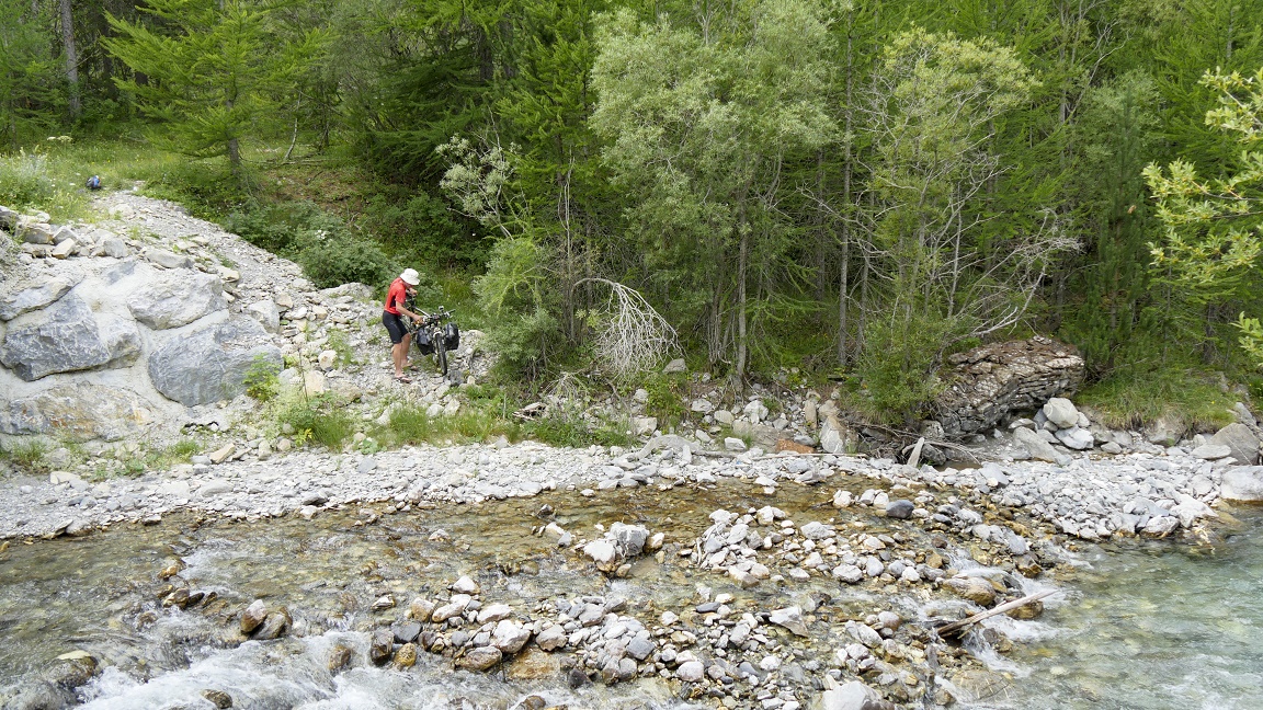
narrow trail do not exist longer, we have to cross the river on
foot, 50 cm of cold water to the knee. With a strong stream, we
must not get out of hand the bike or... the bags!
We continue to
the end of the Lauzanier valley, far away from the main road.
The scenery is amazing, next to the Mercantour park (a first for
me). We reach the Arche/Ark pass at 1991 meters, a stop is required
at Mateo's truck, Italian seller of Italian cheeses. The little
mouse Valérie nibbles soon as I turn my back ... Up
and down is made of: beautiful descent to Bersezio and beautiful
climb up to Ferrero, end of the day. We bivouack with the pass
that we will go up the next day. Sweet dreams into perspective.
|
|
|
|

|
|

|
|
|
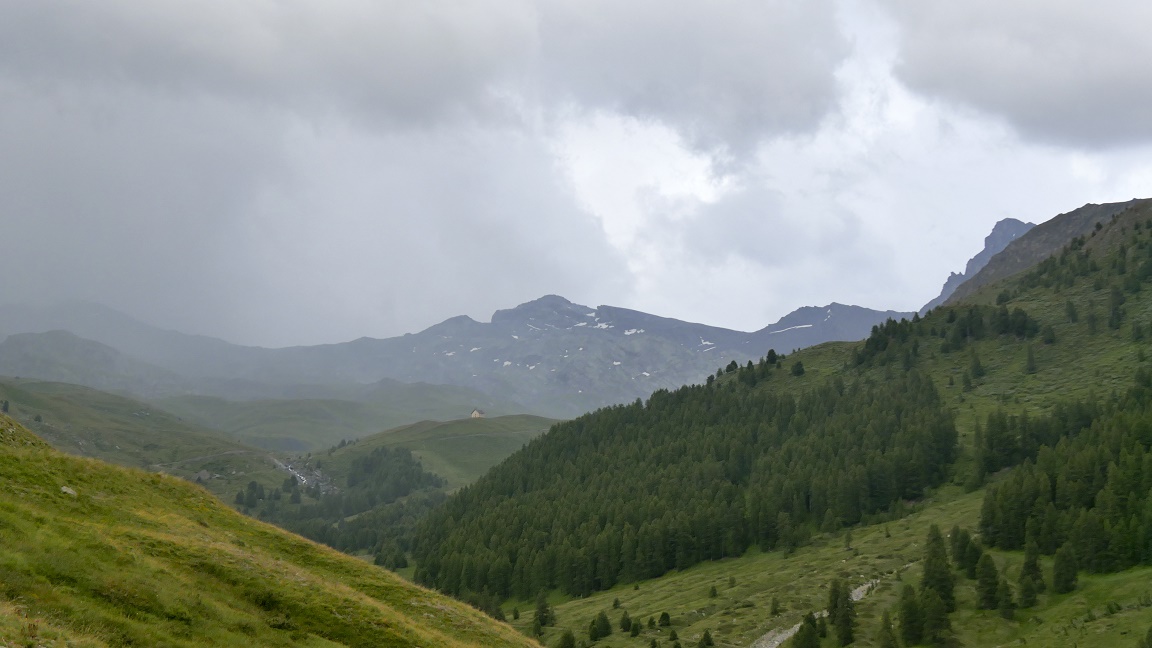
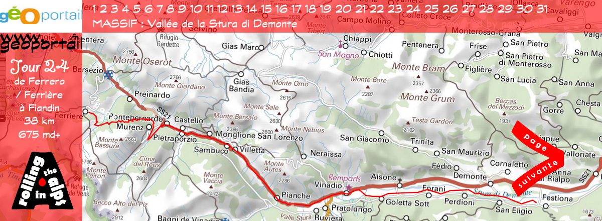
DAY 24
Ferrero / Ferrière - Fiandin
38 km / 675 md+ / 1801 md-
|
 |
The sky is clear and the Becco
Rosso peak in sight. At the beginning, the trail climbs a bit,
but we hold on our saddles, the summit seems close to hand. Not
to mention a beautiful descent into a valley that we could not
see ... the place is really beautiful, but now we must go up agin,
450 meters -evation gain with hyper stiff and brittle slope 15
endless loops with parts grassy that finish us! Hard! Same blueberries
have a bitter taste ...
The pass is so closed that
minutes are interminable under a blazing sun. Hungry
and exhausted at the top, we eat like 4 guys (as usual we eat
like 3!). This quiet moment gives us back a bit of mind and strength
to go forward. Bingo! The afternoon
is rejoicing with stunning alpine views of the Stura Valley. The
trail is pleasant to go down, we swallow 800 meters -evation loss
in few minutes of pure happiness. Using brakes make the arms tired
... with painful fingers! What is next? Small roads in the valley.
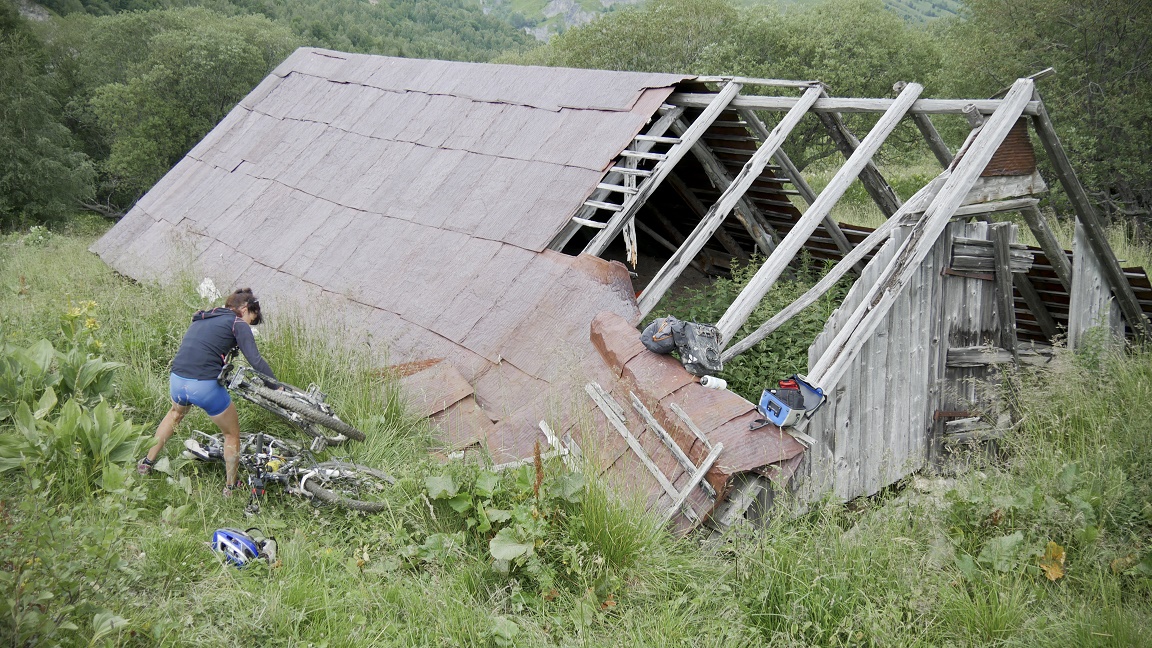
Time to do some shopping, it's time to arrive to Fiandin. Quiet
night on straw in a barn.
|
|
|
|
|
|
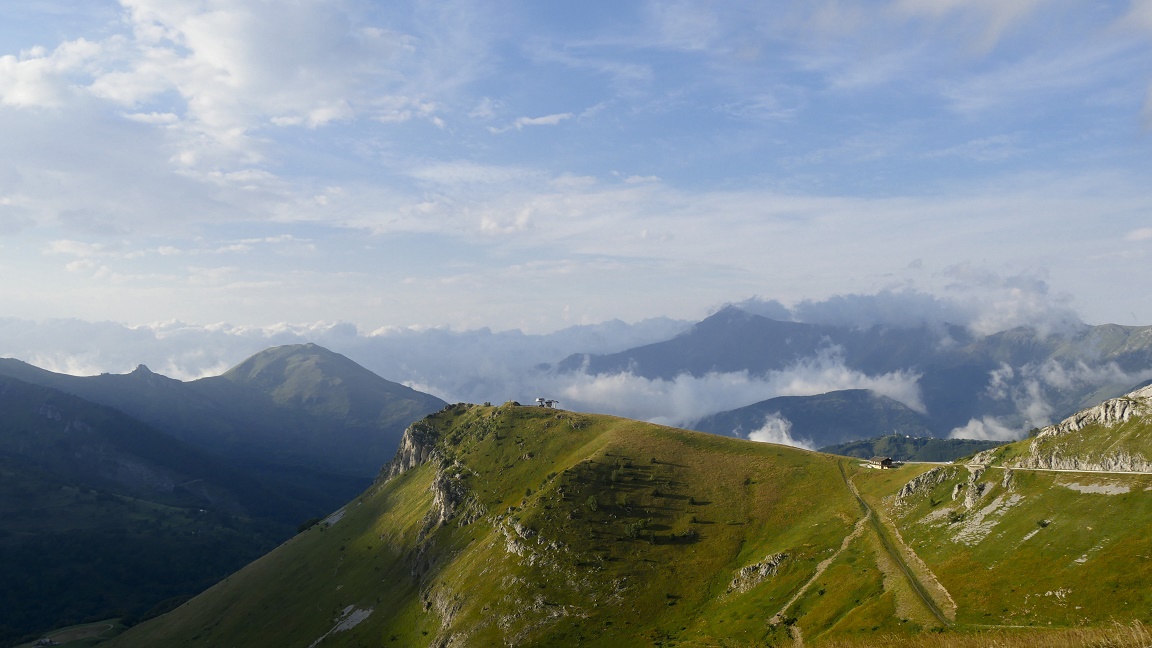
DAY 25
Fiandin - Col de Tende
47 km / 2395 md+ / 1252 md- |
|
We leave our
comfortable cottage to start the day with a climb to the Madona
pass, easy and very pleasant. Italian tifosi acclaim us: we are
aliens mountain bikers... Crazy guys! The
descent to Valdieri is also great with a succession of laces before
taking a path on the edge of forest and river to have lunch. Barbecues
are out but not for us, alas, we needed good meat to climb the
Goderia pass. No sun, but the weather is heavy, heavy sweating
too!
We ride to Limone
Piemonte Valley with very easy single tracks. The two passes of
the morning open the appetite: on a bench we have melons and yoghurt
(it is better by 500 gr) because the road is not yet over for
today. Direction: Col di Tenda. A lot
of cars to the tunnel of Tenda, a lot of crazy racers! There is
one hour more to climb to the pass of Tenda (500 meters -evation
gain), the last meters are rough, hard to go on with a face wind.
We settle the tent in France. The nightshow is sublime.
|
|
|
|
|
|

|
|
|
DAY 26
Col de Tende - La Brigue
40,7 km / 730 md+ / 1579 md-
|
 |
The wind dies down, Italy is
under the clouds while France brights, we have lunch in the sun
with the panoramic view of the Southern Alps. The return on the
saddle is hard ... even when the military road goes down. It runs
along the ridges, alternating between forests and passages over
cliffs; the mountains are always more beautiful. 1250
meters -evation loss done in a (too) short time to reach Tende,
a quick stop to fill in bags. We ride the cobbled streets, difficult
to set foot on the ground. A little break, and here we go again!
The Roya valley borrows at
East to Brigue, picturesque village perched between two mountains.
Pavers blow bikes all over the place, almost harder than a technical
single track! And us? we are still on the saddle, like a rodeo
... At 5 pm, Notre-Dame-des-Fontaines is nearly closed, I just
have time to take a look to the huge paintings, amazing! A place
to see. I suffer in the late afternoon,
no energy to climb, 4 km in an hour, we would have done better
on foot! Bivouac on the wayside.
|
|
|
|
|
|
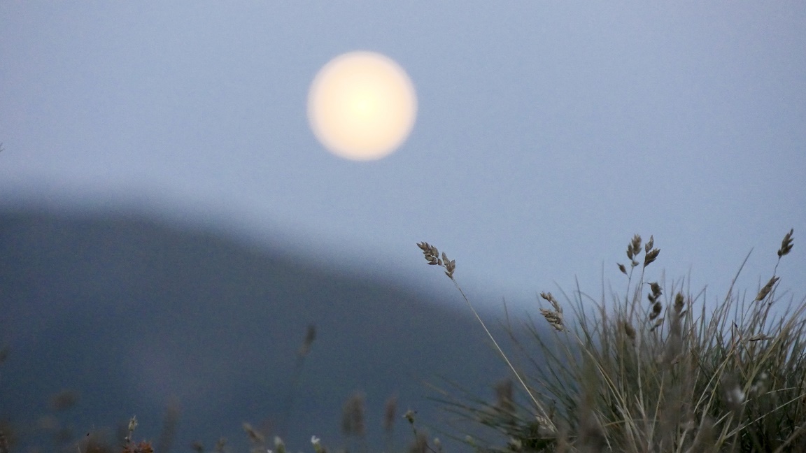
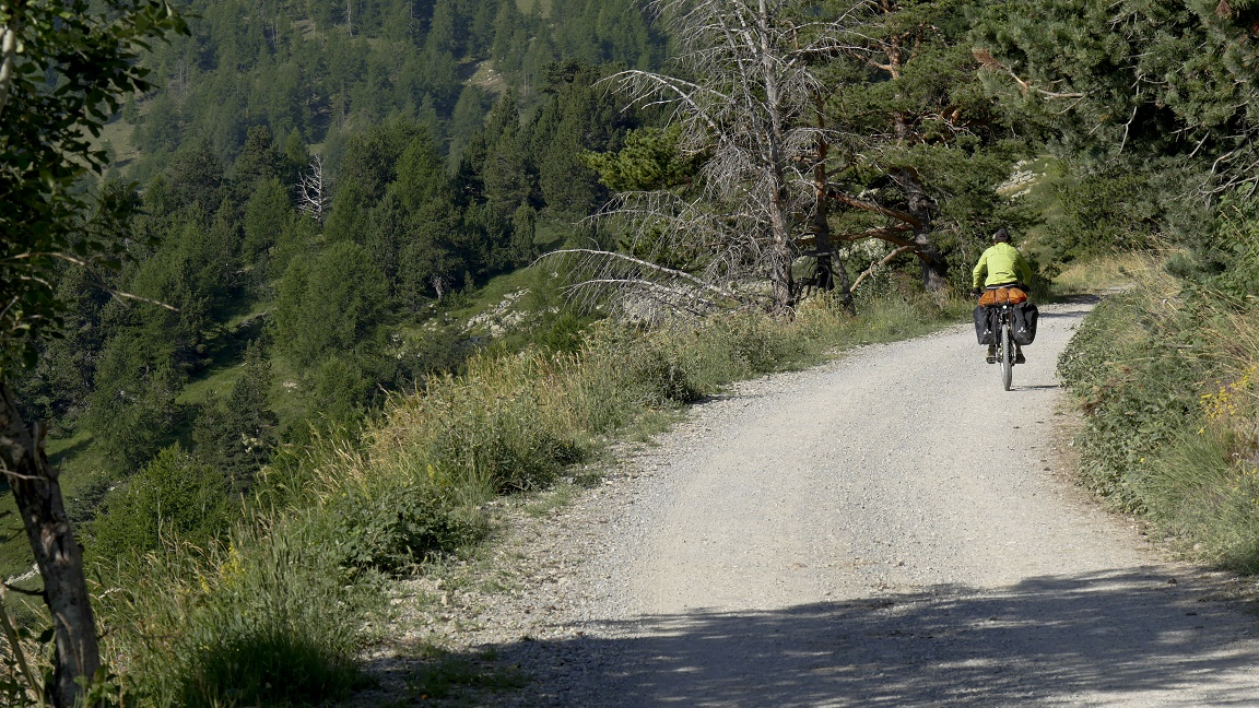
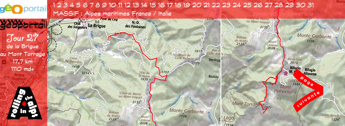
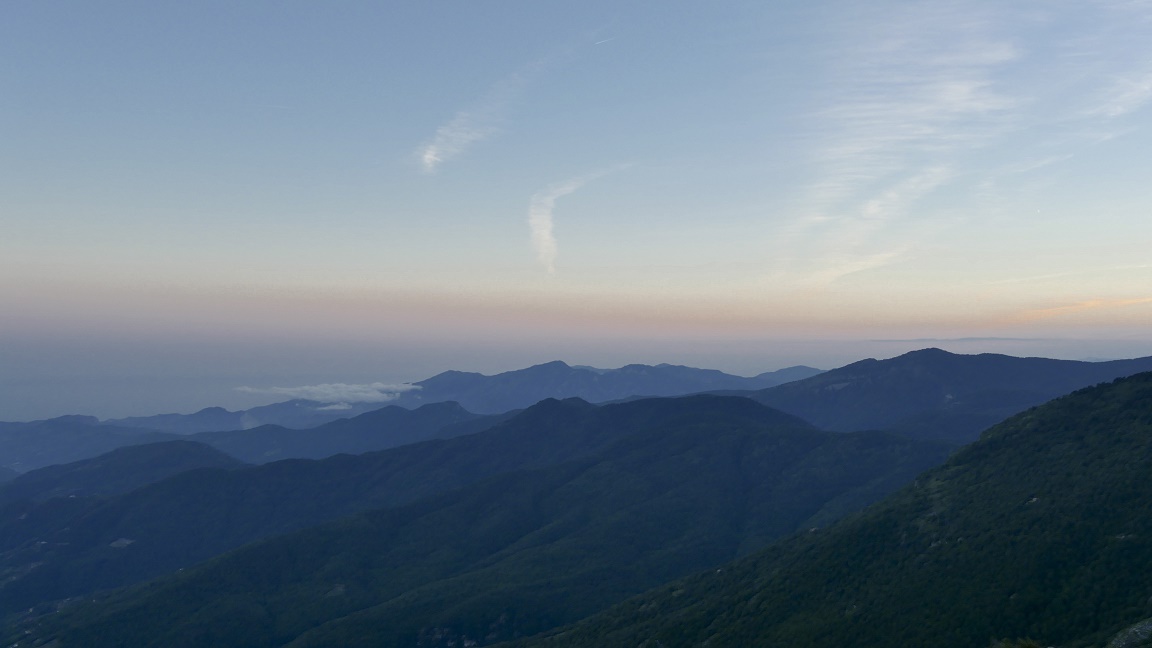
DAY 27
La Brigue - Mont Torrage
17,7 km / 1110 md+ / 646 md- |
|
After a quick
lunch, we easily continue the climb : legs are back. We hold the
wheel of other mountain bikers ... who do not have bags! This
is the Olympic shape to ride on Franco-Italian peaks, from the
Sanson pass, at 1,700 meters. We met
Francis, a 67 years shepherd, one of the outstanding figures of
our trip. The man of character, passion, ardor, he loves his briguasques
goats more than anything else. We talk about the wolf. No problem
for him, but in the gardens of the Elysee palais in Paris!
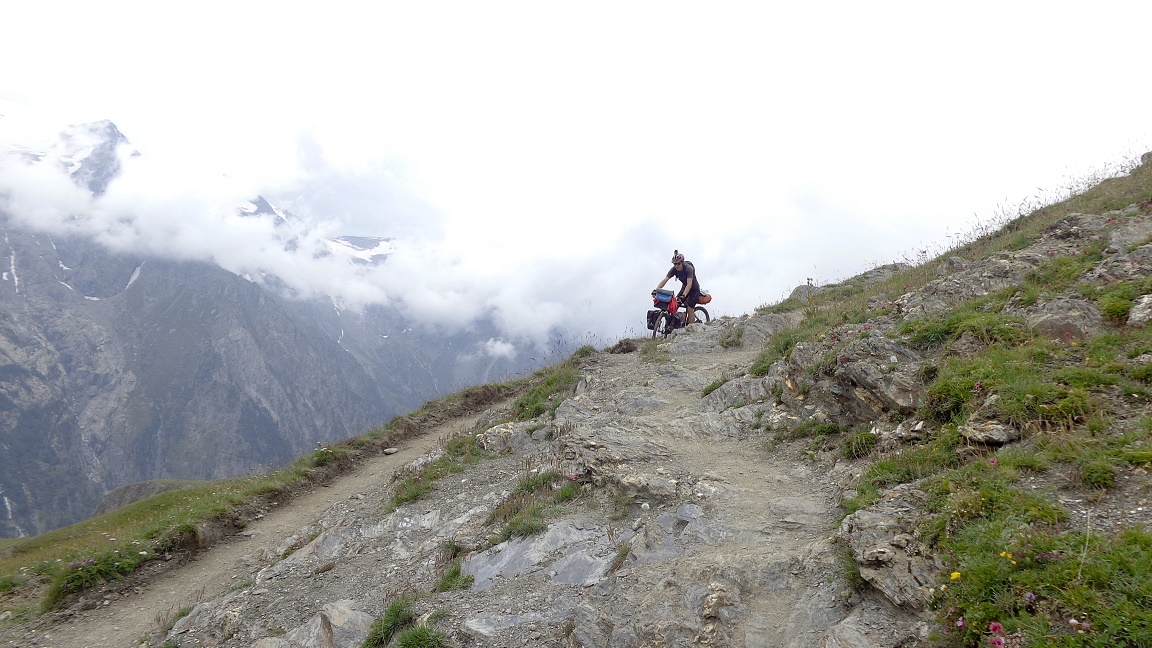
This day is the
most exciting of our journey: the carved path into the rock is
50 cm wide, on one side is the mountain, on the other emptyness.
The ride is risky on this air route, and we cycle two amazing
via ferrata. The trail is more technical than difficult, much
more rolling it seems. Fatigue takes
over as the descent is easy, and generates a series of technical
faults. We stop for the night at the roadside. Evening light facing
the Mediterranean.
|
|
|
|

|
|

|
|
|
DAY 28
Mont Torrage - Olivetta
36,8 km / 810 md+ / 2295 md-
|
 |
This morning, there is not
much to eat, and no coffee. Just one liter of water. The sky is
covered quickly, the beautiful lights of the sun are absorbed
into the gray clouds, it starts on our blank cliff path with a
few drops. Hardly time to get to Muratone
refuge it pours. We stay 3 hours under a 4m square rickety steel
plates, but very useful, especially to fill the cans! Not much
to do but laugh and drink herbal tea to keep warm, the water flows
profusely.
Once ends the storm, we stay
in the mist, the road is waterlogged, ruts are filled to the brim,
feet wade in mud ponds! Then it is a great slippery single going
down to the Saorge valley, but it is impractical with our too
heavy mountain bikes ! I try artistic figures, better than in
a clown show. Good laugh. Finally the
trail gets more quiet, we stay at the sun on the bridge of Castou
to dry stuff. Then we reach Breil-sur-Roya and Olivetta, straight
south. We sleep in the olive trees, fantastic.
|
|
|
|
|
|
DAY 29
Olivetta - Castellar
24 km / 1230 md+ / 665 md- |
|
We leave the
road of Roya to return to France with a nice gourmet break: blackberries
call us to the edge of the road. Direction: Sospel that have no
interest other than to fill in our water bottles. A guy tells
us the direction... explaining he cycled once to the mountain
pass (?!) Whaou! Just a look on this guy, I do not doubt our success!
:) It's cool for the 2 hour climb to
Scuvion pass, 1154 m. Up there is disappointment because we booked
a sea view but the fog is invited. We have lunch with our jackets!
After the Razet
pass, the narrow single track is very nice especially when the
sun comes back. The woodland undergrowth GR 52 rolls well, untim
it becomes large and descents on pebbles that paralyze my arms
and hurts my back. We put the tent
near the Merle srping, on a terrace, next to a barn. We pick up
two kilograms of plums, good for digestive transit! For the first
time, we make a nap in the sun. We are used but happy. All good
things end: in front of us, there is no more roads or tracks,
just the sea ...
|
|
|
|

|
|

|
|
|
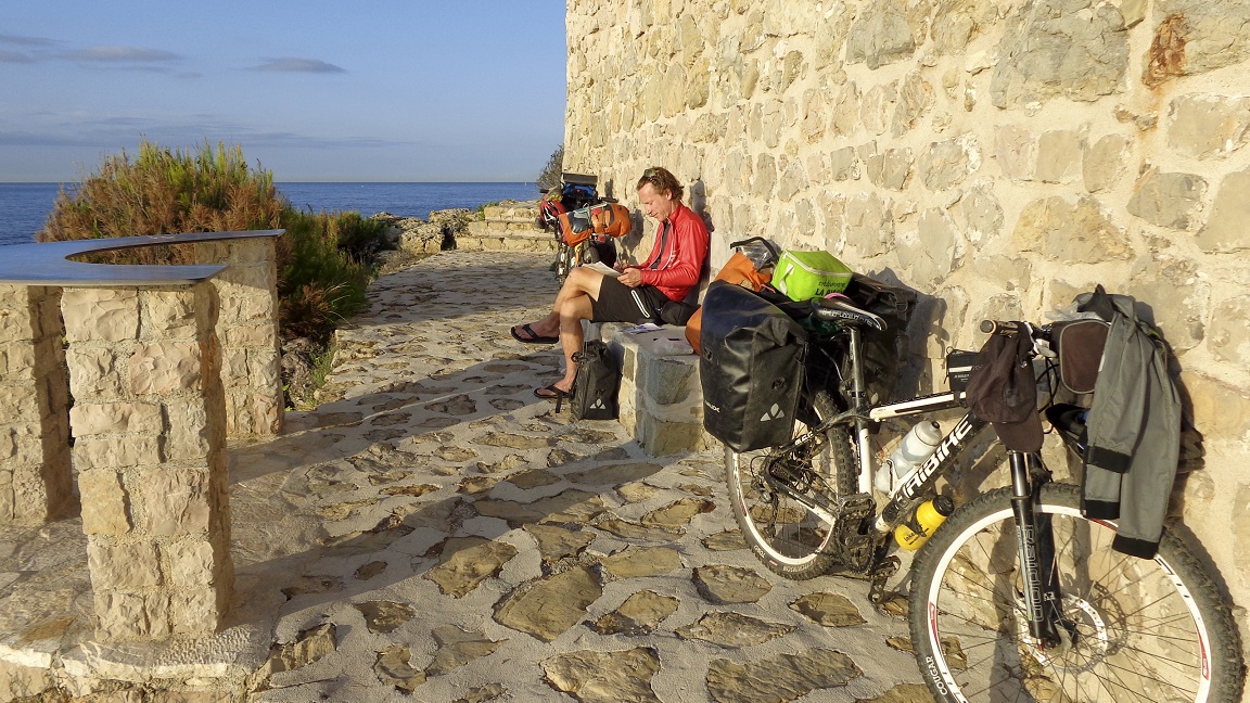
DAY 30
Castellar - Nice / Lyon
53,9 km / 585 md+ / 1358 md-
|
 |
For the last morning, back
hurts, arms are heavy, but the legs are still ok! On the seaside,
there is no real difficulties, except slaloming between cars and
avoiding tourists wearing shorts! On the coast, it's nice, it's
hot, it smells... sweat! We lunch on a bench in Monaco, 4th crossed
country: what an unnecessary luxury! The shade of our palm has
no more value than that the one of a fir trees in Queyras or any
where else. The sea is beautiful, quiet,
and breaks on the coast. We keep pedaling.
This ride on the seashore is
great: Menton, Cap Martin, Monaco, Beaulieu, St Jean Cap Ferrat
... names that make you dream. The air is loaded with iodine,
our feet feel good in the sea, but bikes are never far away. In
Nice, the Promenade des Anglais and the city center are dirty
and sad. We are only two grains of sand lost on the beach, a few
hours wandering the streets ... We
returned to Lyon by train after a month of emotions. Great tourning
bike ride!
And do not forget to live our dreams..
|
|
|
|
|
Daily trip
Main stops:
|
 |
|
|
Toutes les photos de la traversée
intégrales des Alpes à VTT
Transalpes et Intégralpes
Cartes & parcours
au jour le jour
GPX / KML : GPS tracks
|
|
# Part 1 :
transalps
geneva - nice
# Part
2 : swiss paradise
geneva - davos
# Part 3 : let's
go to the dolomites
davos - cortina d'ampezzo
# Part 4 : julian
alpes & balkans
venisz - cortina - ljubljana - istanbul
|
|